| Western Karenni | |||||||||
|---|---|---|---|---|---|---|---|---|---|
| Princely States of the Karenni States | |||||||||
| 1875–1959 | |||||||||
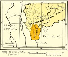
 1917 map of the Karenni States | |||||||||
| Area | |||||||||
• 1901 | 1,631 km2 (630 sq mi) | ||||||||
| Population | |||||||||
• 1901 | 19,964 | ||||||||
| • Type | Monarchy | ||||||||
| History | |||||||||
• Independence under British protection | 21 June 1875 | ||||||||
• Abdication of the Kayah rulers | 1959 | ||||||||
| |||||||||

Western Karenni was the collective name for the four Karenni States located west of the Salween River: Bawlake, Nammekon, Naungpale, and Kyebogyi. On 21 June 1875, the government of British India and king Mindon of Burma signed a treaty recognizing the independence of Western Karenni. On 23 January 1892, Western Karenni was incorporated into British India as a protectorate.[1]
- ^ Khu Oo Reh (October 2006). "Highlights in Karenni History to 1948". Retrieved 19 December 2010.