This article needs additional citations for verification. (October 2018) |
Westmoreland County | |
|---|---|
 | |
 Location within the U.S. state of Pennsylvania | |
 Pennsylvania's location within the U.S. | |
| Coordinates: 40°19′N 79°28′W / 40.31°N 79.47°W | |
| Country | |
| State | |
| Founded | February 26, 1773 |
| Named for | Westmorland |
| Seat | Greensburg |
| Largest city | Hempfield Township |
| Area | |
| • Total | 1,036 sq mi (2,680 km2) |
| • Land | 1,028 sq mi (2,660 km2) |
| • Water | 8.5 sq mi (22 km2) 0.8% |
| Population (2020) | |
| • Total | 354,663 |
| • Density | 345/sq mi (133/km2) |
| Time zone | UTC−5 (Eastern) |
| • Summer (DST) | UTC−4 (EDT) |
| Congressional districts | 13th, 14th |
| Website | www |
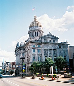
Westmoreland County is a county in the Commonwealth of Pennsylvania, United States, located in the Pittsburgh Metropolitan Statistical Area. As of the 2020 census, the population was 354,663.[1] The county seat is Greensburg and the most populous community is Hempfield Township.[2] It is named after Westmorland, a historic county of England. The county is part of the Southwest Pennsylvania region of the state.[a]
Formed from, successively, Lancaster, Northumberland, and later Bedford counties, Westmoreland County was founded on February 26, 1773, and was the first county in the colony of Pennsylvania whose entire territorial boundary was located west of the Allegheny Mountains. Westmoreland County originally included the present-day counties of Fayette, Washington, Greene, and parts of Beaver, Allegheny, Indiana, and Armstrong counties.
- ^ "Census - Geography Profile: Westmoreland County, Pennsylvania". United States Census Bureau. Retrieved December 18, 2022.
- ^ "Find a County". National Association of Counties. Retrieved June 7, 2011.
Cite error: There are <ref group=lower-alpha> tags or {{efn}} templates on this page, but the references will not show without a {{reflist|group=lower-alpha}} template or {{notelist}} template (see the help page).

