| Weymouth Back River | |
|---|---|
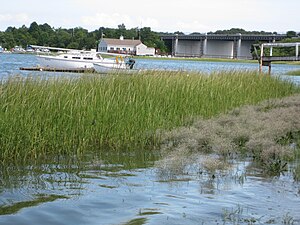
 David's Island at Weymouth Back River Bridge (Route 3A) | |
 | |
| Location | |
| Country | United States |
| State | Massachusetts |
| Cities | Weymouth, Hingham |
| Physical characteristics | |
| Source | Whitman's Pond |
| • location | East Weymouth, Massachusetts, United States |
| • coordinates | 42°12′45″N 70°55′40″W / 42.21250°N 70.92778°W |
| • elevation | 20.5 ft (6.2 m) |
| Mouth | Hingham Bay |
• location | Weymouth, Massachusetts, United States |
• coordinates | 42°15′52″N 70°55′1″W / 42.26444°N 70.91694°W |
• elevation | 0 ft (0 m) |
| Basin features | |
| Tributaries | |
| • right | Fresh River (Massachusetts) |
The Weymouth Back River, sometimes called Back River, is a short, primarily tidal river in Hingham and Weymouth, Massachusetts, about 10 miles (16 km) south of Boston. It arises from a number of tributaries in ponds and swamps, most notably Whitmans Pond, flows northward, and empties into Hingham Bay just south of Grape Island and Slate Island.[1]