Wheatland | |
|---|---|
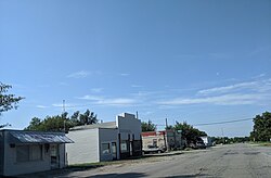
 Main Street in Wheatland, 2019 | |
| Coordinates: 35°23′52″N 97°39′8″W / 35.39778°N 97.65222°W | |
| Country | United States |
| State | Oklahoma |
| County | Oklahoma |
| Elevation | 1,319 ft (402 m) |
| Population (2000) | |
| • Total | 39 |
| Time zone | UTC-6 (Central (CST)) |
| • Summer (DST) | UTC-5 (CDT) |
| ZIP codes | 73097, 73169 |
| GNIS feature ID | 1100120[1] |

Wheatland is a neighborhood located on State Highway 152 in southwestern Oklahoma City, Oklahoma, United States.[2] ZIP Codes that cover the area include 73097 and 73169.
- ^ a b U.S. Geological Survey Geographic Names Information System: Wheatland, Oklahoma
- ^ Oklahoma City, OK (Wheatland). Neighborhood Scout. https://www.neighborhoodscout.com/ok/oklahoma-city/wheatland#overview

