| Wheeling Creek | |
|---|---|
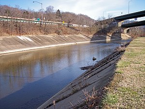
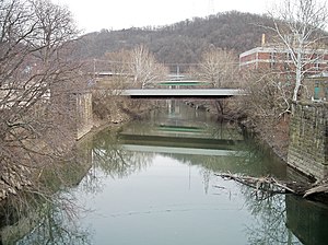
 Wheeling Creek in Wheeling in 2006 | |
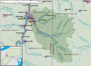
 A map of Wheeling Creek and its watershed | |
| Location | |
| Country | United States |
| State | West Virginia |
| Counties | Marshall, Ohio |
| Physical characteristics | |
| Source | Enlow Fork |
| • location | boundary of Greene and Washington Counties, Pennsylvania |
| • coordinates | 40°00′08″N 80°20′27″W / 40.00222°N 80.34083°W[1] |
| • elevation | 1,339 ft (408 m)[2] |
| 2nd source | Dunkard Fork |
| • location | Confluence of North Fork and South Fork, Richhill Township, Greene County, Pennsylvania |
| • coordinates | 39°53′33″N 80°28′41″W / 39.89250°N 80.47806°W[3] |
| • elevation | 927 ft (283 m)[2] |
| Source confluence | |
| • location | northeastern Marshall County near Majorsville, West Virginia |
| • coordinates | 39°57′15″N 80°31′43″W / 39.95417°N 80.52861°W[4] |
| • elevation | 829 ft (253 m)[2] |
| Mouth | Ohio River |
• location | Wheeling, West Virginia |
• coordinates | 40°03′50″N 80°43′30″W / 40.06389°N 80.72500°W[4] |
• elevation | 630 ft (190 m)[2] |
| Length | 25 mi (40 km)[4] |
| Basin size | 300 sq mi (780 km2)approx.[5] |
| Discharge | |
| • location | mouth |
| • average | 373.5 cu ft/s (10.58 m3/s) (estimate)[6] |
| Basin features | |
| Progression | Ohio River → Mississippi River → Gulf of Mexico |
| Tributaries | |
| • left | Dunkard Fork Wolf Run Stull Run Burch Run Bald Eagle Hollow Hollidays Run Seabright Hollow Jakes Run |
| • right | Enlow Fork Turkey Run Bruce Run Cricket Hollow Grandstaff Run Britt Run Little Wheeling Creek Carter Run Long Run |


Wheeling Creek is a tributary of the Ohio River, 25 miles (40 km) long, in the northern panhandle of West Virginia, with a watershed extending into southwestern Pennsylvania. Via the Ohio River, it is part of the watershed of the Mississippi River, draining an area of approximately 300 square miles (780 km2) on the unglaciated portion of the Allegheny Plateau. It flows into the Ohio River in downtown Wheeling, just downstream of Ohio's Wheeling Creek on the opposite bank.[7] A variant name is Big Wheeling Creek.[4] According to the French explorer Pierre Joseph Céloron de Blainville, the native name of the stream is the Kanououara River, as was inscribed on the lead plate buried at the mouth by the Ohio River in 1749. [8]
- ^ Geographic Names Information System. "Geographic Names Information System entry for Enlow Fork (Feature ID #1174270)". Retrieved 2007-03-17.
- ^ a b c d Google Earth elevation for GNIS coordinates. Retrieved on 2007-06-14.
- ^ Geographic Names Information System. "Geographic Names Information System entry for Dunkard Fork (Feature ID #1173610)". Retrieved 2007-03-17.
- ^ a b c d Geographic Names Information System. "Geographic Names Information System entry for Wheeling Creek (Feature ID #1548996)". Retrieved 2007-03-17.
- ^ Ward, S. M.; G. R. Crosby. "Water Resources Data, West Virginia, Water Year 2005". United States Geological Survey. pp. Upper Ohio and Little Kanawha River Basins. Retrieved 2007-06-14.
- ^ United States Environmental Protection Agency. "Watershed Report: Wheeling Creek". watersgeo.epa.gov. Archived from the original on 2021-07-05. Retrieved 2021-07-05.
- ^ West Virginia Atlas & Gazetteer. Yarmouth, Me.: DeLorme. 1997. p. 21. ISBN 0-89933-246-3.
- ^ "Leaden Plate Buried at Wheeling Creek > Research | Ohio County Public Library | Ohio County Public Library | Wheeling West Virginia | Ohio County WV | Wheeling WV History |".