Whiteman Airport | |||||||||||
|---|---|---|---|---|---|---|---|---|---|---|---|
 | |||||||||||
| Summary | |||||||||||
| Airport type | Public | ||||||||||
| Operator | Los Angeles County | ||||||||||
| Serves | Greater Los Angeles | ||||||||||
| Location | Pacoima | ||||||||||
| Opened | 1946 | ||||||||||
| Elevation AMSL | 305.7 m / 1,003 ft | ||||||||||
| Coordinates | 34°15′33.57″N 118°24′48.35″W / 34.2593250°N 118.4134306°W | ||||||||||
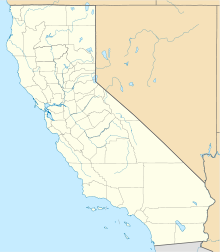
| Map | |||||||||||
 | |||||||||||
| Runways | |||||||||||
| |||||||||||
Whiteman Airport (IATA: WHP, ICAO: KWHP, FAA LID: WHP) is a general aviation airport in the northeastern San Fernando Valley community of Pacoima, in the city of Los Angeles, California, United States.
The airport was founded as Whiteman Air Park in 1946 on a farm by pilot Marvin Whiteman Sr. as a non-tower controlled, private airport. Later, Whiteman Manufacturing Co. was built on the airport's west side. In 1970, the airport was purchased by the County of Los Angeles. During the 1980s, the name was changed to "Whiteman Airport", but it is still commonly referred to as "Whiteman Airpark" by old-time local pilots.[1]
The airport is open to general aviation aircraft 24 hours a day, seven days a week. It is home to over 600 aircraft, and numerous aviation-related businesses.[2][3] The airport can handle small aircraft as well as medium turboprops and jets, although little jet traffic is seen on its rather narrow runway. The control tower is operated by Serco (not the FAA) and is in operation daily. The single runway has runway end identifier lights (REILs), pilot controlled medium-intensity runway lighting (MIRLs) and a precision approach path indicator (PAPI). Full- and self-service fuel is available around the clock. The airport has an automated weather observing system (AWOS) with data available continuously by radio and telephone.[3]
- ^ Los Angeles Times, February 1, 1987: "Airport Panel Seeks Tower at Whiteman" Linked 2014-05-17
- ^ Martha, Willman (1 March 1998). "Safety Record Vexes Airfield on City Fringe". Los Angeles Times. Archived from the original on December 24, 2013. Retrieved 23 December 2013.
- ^ a b "Whiteman Airport". Los Angeles Department of Public Works. 2013. Retrieved 3 February 2014.


