| Whitewater State Park | |
|---|---|
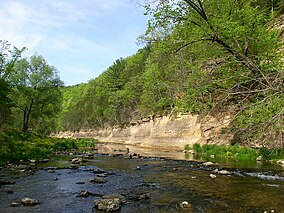
 The Whitewater River in Whitewater State Park | |
| Location | Winona, Minnesota, United States |
| Coordinates | 44°3′N 92°3′W / 44.050°N 92.050°W |
| Area | 1,672 acres (6.77 km2) |
| Elevation | 899 ft (274 m)[1] |
| Established | 1919 |
| Governing body | Minnesota Department of Natural Resources |
Whitewater State Park CCC/WPA/Rustic Style Historic Resources | |
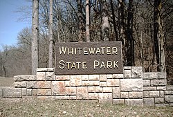
 Sign at the south entrance to the park | |
| Location | Off Minnesota State Highway 74, Elba Township, Minnesota |
|---|---|
| Coordinates | 44°3′15″N 92°2′45″W / 44.05417°N 92.04583°W |
| Area | 563 acres (228 ha) |
| Built | 1934–41 |
| Architect | National Park Service, Civilian Conservation Corps, Works Progress Administration |
| Architectural style | National Park Service rustic |
| MPS | Minnesota State Park CCC/WPA/Rustic Style MPS |
| NRHP reference No. | 89001661 |
| Added to NRHP | October 25, 1989 |
Whitewater State Park is a state park of Minnesota, United States, preserving a stretch of the Whitewater River surrounded by rocky bluffs. It is located in Winona County in the southeastern blufflands area of the state. The 2,700-acre (11 km2) park features scenic overlooks and trout fishing in the spring-fed Whitewater River and Trout Run Creek. It has about 300,000 visitors annually, and is located 7 miles (11 km) north of St. Charles on Minnesota State Highway 74, which runs through the park.
- ^ "Whitewater State Park". Geographic Names Information System. United States Geological Survey. January 11, 1980. Retrieved June 29, 2015.

