Wigram | |
|---|---|
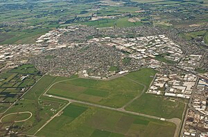
 The former Wigram Aerodrome, which has since been converted into the Wigram Skies development | |
 Location of Wigram in Christchurch. | |
| Coordinates: 43°33′12″S 172°33′30″E / 43.5533°S 172.5584°E | |
| Country | New Zealand |
| City | Christchurch |
| Local authority | Christchurch City Council |
| Electoral ward |
|
| Community board | Waipuna Halswell-Hornby-Riccarton |
| Established | 1923 |
| Area | |
| • Land | 444 ha (1,097 acres) |
| Population (June 2024)[3] | |
| • Total | 11,900 |
| Airports | Wigram Aerodrome (former) |
| Hei Hei | Sockburn | Upper Riccarton |
| Hornby |
|
Middleton |
| Halswell | Aidanfield | Hillmorton |
Wigram is a suburb in the southwest of Christchurch, New Zealand. The suburb lies close to the industrial estates of Sockburn and the satellite retail and residential zone of Hornby, and has undergone significant growth in recent years due to housing developments. It is seven kilometres to the west of the city centre.
- ^ "Wards, Councillors and Community Boards map". ccc.govt.nz. Christchurch City Council. Retrieved 14 August 2020.
- ^ Cite error: The named reference
Areawas invoked but never defined (see the help page). - ^ "Aotearoa Data Explorer". Statistics New Zealand. Retrieved 26 October 2024.