| Wigry National Park | |
|---|---|
| Polish: Wigierski Park Narodowy | |
 | |
| Location | Podlaskie Voivodeship, Poland |
| Nearest city | Suwałki |
| Coordinates | 54°00′N 23°03′E / 54.000°N 23.050°E |
| Area | 150.86 km2 (58.25 sq mi) |
| Established | 1989 |
| Governing body | Ministry of the Environment |
| www | |
| Official name | Wigry National Park |
| Designated | 29 October 2002 |
| Reference no. | 1567[1] |
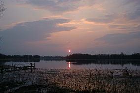
Wigry National Park (Polish: Wigierski Park Narodowy) is a national park in Podlaskie Voivodeship in northeastern Poland. It covers parts of the Masurian Lake District and Augustów Primeval Forest (Puszcza Augustowska). It is named after Lake Wigry, the largest of the park's many lakes. It is also designated as a Ramsar wetland site, one of 13 such sites in Poland.


The park was created on January 1, 1989, on an area of 149.56 km2. Today it is slightly larger at 150.86 km2 (58.25 sq mi), of which 94.64 km2 is forest, 29.08 km2 is water, and 27.14 km2 is other types of land, mostly agricultural. Strictly protected zones account for 6.23 km2, including 2.83 km2 of woods. The park has its headquarters in the town of Suwałki.
The park’s landscape was to a large extent shaped by a glacier which covered this region around 12,000 years ago. While slowly receding to the north, the glacier formed valleys, many of which are filled with water in the form of lakes. Some of the shallowest lakes have in the course of time become peat-bogs. The northern part of the park is hilly, with elevation reaching 180 meters above sea level. The southern part is flat and is mainly covered with a forest, which is part of the broader Puszcza Augustowska.
The park is famous for its numerous lakes of different shape, size, and depth. Altogether, there are 42 of them, the biggest, Wigry, covering an area of 21.87 km2 with a maximum depth of 73 meters, is located in the central part of the park. The main river is Czarna Hańcza, which crosses Lake Wigry, and forms a popular kayaking route.
- ^ "Wigry National Park". Ramsar Sites Information Service. Retrieved 25 April 2018.

