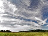
Cirrus clouds are atmospheric clouds characterized by thin, wispy strands, often bunched into tufts. They range in color from white to faint gray and form when water vapor undergoes deposition at altitudes above 5,000 m (16,500 ft) in temperate regions and above 6,000 m (20,000 ft) in tropical regions. They also form from the outflow of tropical cyclones or the anvils of cumulonimbus clouds. Since these cirrus clouds arrive in advance of the frontal system or tropical cyclone, they indicate that the weather conditions may soon deteriorate. While they can indicate the arrival of precipitation, cirrus clouds themselves produce only fall streaks (falling ice crystals that evaporate before landing on the ground). Jet streams can stretch cirrus clouds across continents, but the clouds will remain only a few kilometers deep. When visible light interacts with the ice crystals in cirrus clouds, it can produce glories, sun dogs, and fire rainbows. (Full article...)
