| Wild Rice River | |
|---|---|
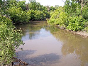
 The Wild Rice River near Abercrombie in 2007 | |
 The Red River drainage basin, with the Wild Rice Rivers of North Dakota and Minnesota highlighted | |
| Location | |
| Country | United States |
| State | North Dakota |
| Physical characteristics | |
| Source | |
| • location | Brampton Township, Sargent County |
| • coordinates | 46°00′56″N 97°47′08″W / 46.01556°N 97.78556°W[1] |
| • elevation | 1,283 ft (391 m)[2] |
| Mouth | Red River of the North |
• location | near Frontier, Cass County |
• coordinates | 46°45′24″N 96°47′24″W / 46.75667°N 96.79000°W[1] |
• elevation | 879 ft (268 m)[2] |
| Length | 251 mi (404 km)[3] |
| Basin size | 2,233 sq mi (5,780 km2)[4] |
| Discharge | |
| • location | near Abercrombie[5] |
| • average | 104 cu ft/s (2.9 m3/s)[5] |
| • minimum | 0 cu ft/s (0 m3/s) |
| • maximum | 9,540 cu ft/s (270 m3/s) |
| Discharge | |
| • location | near Rutland[6] |
| • average | 8.36 cu ft/s (0.237 m3/s)[6] |
The Wild Rice River is a tributary of the Red River of the North, approximately 251 miles (404 km) long,[3] in southeastern North Dakota in the United States. Via the Red River, Lake Winnipeg, and the Nelson River, it is part of the watershed of Hudson Bay. The Wild Rice River drains an area of 2,233 square miles (5,780 km2) in the Red River Valley region. Its tributaries also drain a small part of northeastern South Dakota. Despite its length, it is a fairly small stream, flowing at an average rate of approximately 100 cubic feet per second (3 m³/s).
The river was so named for the former abundance of wild rice along its course.[7]
- ^ a b Geographic Names Information System.
- ^ a b Google Earth.
- ^ a b U.S. Geological Survey. National Hydrography Dataset high-resolution flowline data. The National Map Archived 2012-03-29 at the Wayback Machine, accessed June 8, 2011
- ^ Red River of the North, Reconnaissance Report.
- ^ a b Robinson, pp. 44-45
- ^ a b Cite error: The named reference
USGS2was invoked but never defined (see the help page). - ^ Federal Writers' Project (1938). North Dakota, a Guide to the Northern Prairie State. WPA. p. 194. ISBN 978-1-62376-033-5.