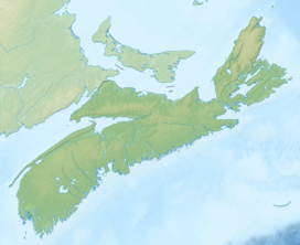
| Wilkie Sugar Loaf | |
|---|---|
 | |
| Highest point | |
| Elevation | 411.8 m (1,351 ft)[1][2] |
| Prominence | 220 m (720 ft)[3] |
| Coordinates | 46°57′19″N 60°28′21″W / 46.95528°N 60.47250°W |
| Naming | |
| Etymology | family name of pioneer settlers + pyramidal shape of mountain |
| Native name | Squa-dichk (Mi'kmaq)[4] |
| Geography | |
| Parent range | Cape Breton Highlands |
| Topo map | NTS 11K16 Dingwall |
| Climbing | |
| Easiest route | Hike |
Wilkie Sugar Loaf is a Canadian peak in the Cape Breton Highlands near the community of Sugar Loaf in the province of Nova Scotia.[5]
- ^ "Geology - Dingwall- Cape Breton Island". Geological Survey of Canada. 1963. Retrieved May 5, 2012.
- ^ Patterson, George Geddie (1978) [First published 1885]. "Chapter 13, FIRST SETTLERS AT ASPY BAY AND OTHER PLACES TO THE NORTH". Patterson's history of Victoria County, Cape Breton, Nova Scotia: With related papers (Hardcover). Sydney, NS: College of Cape Breton Press. p. 124. ISBN 978-0920336021.
- ^ "Bivouac.com entry for "Wilkie Sugar Loaf Nova Scotia #31846"". Bivouac.com. Retrieved May 5, 2012.
- ^ "Place-names of the province of Nova Scotia (1922), by Thomas J Brown". Royal Print & Litho., Halifax, N.S. Retrieved May 5, 2012.
- ^ "Wilkie Sugar Loaf". Geographical Names Data Base. Natural Resources Canada.
