Will County | |
|---|---|
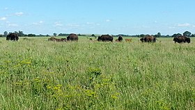
Flanders House in Plainfield (1840), Midewin National Tallgrass Prairie. | |
 Location within the U.S. state of Illinois | |
 Illinois's location within the U.S. | |
| Coordinates: 41°26′42″N 87°58′43″W / 41.44503°N 87.97866°W | |
| Country | |
| State | |
| Founded | January 12, 1836 |
| Named for | Conrad Will |
| Seat | Joliet |
| Largest city | Joliet |
| Area | |
| • Total | 849 sq mi (2,200 km2) |
| • Land | 837 sq mi (2,170 km2) |
| • Water | 12 sq mi (30 km2) 1.5% |
| Population (2020) | |
| • Total | 696,355 |
| • Density | 820/sq mi (320/km2) |
| Time zone | UTC−6 (Central) |
| • Summer (DST) | UTC−5 (CDT) |
| Congressional districts | 1st, 2nd, 11th, 14th |
| Website | willcounty |
Will County is a county in the northeastern part of the state of Illinois. According to the 2020 census, it had a population of 696,355, an increase of 2.8% from 677,560 in 2010, making it Illinois's fourth-most populous county.[1] The county seat is Joliet.[2] Will County is one of the five collar counties of the Chicago–Naperville–Elgin, IL–IN–WI Metropolitan Statistical Area. The portion of Will County around Joliet uses area codes 815 and 779, while 630 and 331 are for far northern Will County and 708 is for central and eastern Will County.
- ^ "U.S. Census Bureau QuickFacts: Will County, Illinois". www.census.gov. Retrieved August 29, 2021.
- ^ "Find a County". National Association of Counties. Archived from the original on May 31, 2011. Retrieved June 7, 2011.

