Williamson County | |
|---|---|
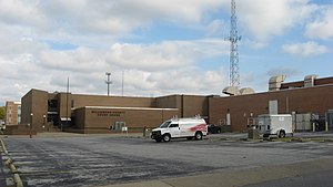
 Williamson County Courthouse in Marion | |
 Location within the U.S. state of Illinois | |
 Illinois's location within the U.S. | |
| Coordinates: 37°44′N 88°56′W / 37.73°N 88.93°W | |
| Country | |
| State | |
| Founded | February 28, 1839 |
| Named for | Williamson County, Tennessee |
| Seat | Marion |
| Largest city | Marion |
| Area | |
• Total | 444 sq mi (1,150 km2) |
| • Land | 420 sq mi (1,100 km2) |
| • Water | 24 sq mi (60 km2) 5.4% |
| Population (2020) | |
• Total | 67,153 |
| • Density | 150/sq mi (60/km2) |
| Time zone | UTC−6 (Central) |
| • Summer (DST) | UTC−5 (CDT) |
| Congressional district | 12th |
| Website | www |
Williamson County is a county in Southern Illinois. At the 2020 census, it had a population of 67,153.[1] The largest city and county seat is Marion.[2]
Williamson County is included in the Carbondale-Marion, IL Metropolitan Statistical Area. This area of Southern Illinois is known locally as "Little Egypt".[citation needed]
Williamson is in the Metro Lakeland area, 88 miles (142 km) southeast of St. Louis, Missouri. Via the nearby intersection of Interstates 57 and 24, and Illinois Route 13, a primary east–west four-lane expressway, the city has access to the major communities of Murphysboro, Carbondale, Carterville, Herrin, Marion and Harrisburg.
The Metro Lakeland area of Jackson-Williamson counties has a total of 120,000 residents. Carbondale (14 miles west), Herrin and Marion are the key urban areas in Metro Lakeland, with a combined population of more than 65,000. Over 235,000 people live within 35 miles (56 km).
- ^ "State & County QuickFacts". United States Census Bureau. Archived from the original on June 7, 2011. Retrieved July 9, 2014.
- ^ "Find a County". National Association of Counties. Retrieved June 7, 2011.