| Wilson State Park | |
|---|---|
 | |
| Location | Wilson, Russell, Kansas, United States |
| Coordinates | 38°55′00″N 98°30′16″W / 38.91667°N 98.50444°W[1] |
| Area | 945 acres (382 ha) |
| Elevation | 1,594 ft (486 m)[1] |
| Established | 1966 |
| Visitors | 334,652 (in 2022)[2] |
| Governing body | Kansas Department of Wildlife, Parks and Tourism |
| Website | Wilson State Park |
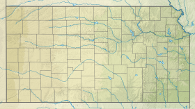
Wilson State Park is a public recreation area found on the south shore of 9,000-acre (3,600 ha) Wilson Lake reservoir approximately 10 miles (16 km) north of the city of Wilson in Russell County, Kansas, United States. Located at the reservoir's eastern end, the state park covers 945 acres (382 ha) divided into two areas by the reservoir's southeastern arm: the Hell Creek area on the west side and the Otoe area on the east side. The Hell Creek area hosts a marina. Both areas include hiking trails, swimming beaches, boat ramps, and camping facilities.[3][4][5]
- ^ a b "Wilson State Park". Geographic Names Information System. United States Geological Survey, United States Department of the Interior.
- ^ Self, Matthew (August 18, 2023). "Top 5 most popular Kansas state parks revealed". KSNT.
- ^ Cite error: The named reference
kdwptwas invoked but never defined (see the help page). - ^ Cite error: The named reference
guidewas invoked but never defined (see the help page). - ^ Cite error: The named reference
CorpsMapwas invoked but never defined (see the help page).
