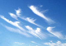
Wind shear (/ʃɪər/; also written windshear), sometimes referred to as wind gradient, is a difference in wind speed and/or direction over a relatively short distance in the atmosphere. Atmospheric wind shear is normally described as either vertical or horizontal wind shear. Vertical wind shear is a change in wind speed or direction with a change in altitude. Horizontal wind shear is a change in wind speed with a change in lateral position for a given altitude.[1]
Wind shear is a microscale meteorological phenomenon occurring over a very small distance, but it can be associated with mesoscale or synoptic scale weather features such as squall lines and cold fronts. It is commonly observed near microbursts and downbursts caused by thunderstorms, fronts, areas of locally higher low-level winds referred to as low-level jets, near mountains, radiation inversions that occur due to clear skies and calm winds, buildings, wind turbines, and sailboats. Wind shear has significant effects on the control of an aircraft, and it has been the only or a contributing cause of many aircraft accidents.
Sound movement through the atmosphere is affected by wind shear, which can bend the wave front, causing sounds to be heard where they normally would not. Strong vertical wind shear within the troposphere also inhibits tropical cyclone development but helps to organize individual thunderstorms into longer life cycles which can then produce severe weather. The thermal wind concept explains how differences in wind speed at different heights are dependent on horizontal temperature differences and explains the existence of the jet stream.[2]

- ^ "Vertical wind shear. Retrieved on 2015-10-24".
- ^ "Low-Level Wind Shear". Integrated Publishing. Retrieved 2007-11-25.