| Wood Green | |
|---|---|
| District | |
|
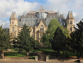
From top to bottom: Shopping City centre; Wood Green Crown Court | |
Location within Greater London | |
| Population | 28,453 (Noel Park and Woodside wards)[1] |
| OS grid reference | TQ305905 |
| • Charing Cross | 6.7 mi (10.8 km) S |
| London borough | |
| Ceremonial county | Greater London |
| Region | |
| Country | England |
| Sovereign state | United Kingdom |
| Post town | LONDON |
| Postcode district | N22, N8, N15 |
| Dialling code | 020 |
| Police | Metropolitan |
| Fire | London |
| Ambulance | London |
| UK Parliament | |
| London Assembly | |


Wood Green is a suburban district of the London Borough of Haringey, London, England. Its postal district is N22, with parts in N8 or N15. The London Plan identifies it as one of the metropolitan centres in Greater London,[2] and today it forms a major commercial district of north London.[3]
Formerly lying within the western part of Tottenham and the county of Middlesex, it became part of both Haringey and Greater London in 1965. Wood Green lies directly east of Alexandra Palace. It is 6.5 miles (10.5 km) from Charing Cross in central London.
- ^ 2011 Census Archived 22 February 2014 at the Wayback Machine Wood Green does not fit exactly into electoral wards but the figures for Noel Park and Woodside give a rough approximation.
- ^ Mayor of London (February 2008). "London Plan (Consolidated with Alterations since 2004)" (PDF). Greater London Authority. Archived (PDF) from the original on 2 June 2010. Retrieved 2 August 2009.
- ^ "144–146 High Road, Wood Green" (PDF). Allsop. Archived (PDF) from the original on 26 March 2020. Retrieved 4 May 2020.


