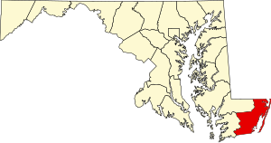
Worcester County | |
|---|---|
 | |
 Location within the U.S. state of Maryland | |
 Maryland's location within the U.S. | |
| Coordinates: 38°14′N 75°17′W / 38.23°N 75.28°W | |
| Country | |
| State | |
| Founded | 1742 |
| Named for | Family of Marquess of Worcester |
| Seat | Snow Hill |
| Largest community | Ocean Pines |
| Area | |
| • Total | 695 sq mi (1,800 km2) |
| • Land | 468 sq mi (1,210 km2) |
| • Water | 227 sq mi (590 km2) 33% |
| Population (2020) | |
| • Total | 52,460 |
| • Density | 75/sq mi (29/km2) |
| Time zone | UTC−5 (Eastern) |
| • Summer (DST) | UTC−4 (EDT) |
| Congressional district | 1st |
| Website | www |
Worcester County /ˈwʊrstər/ is the easternmost county of the U.S. state of Maryland. As of the 2020 census, the population was 52,460.[1] Its county seat is Snow Hill.[2] The county is part of the Lower Eastern Shore region of the state.
It is the only county of Maryland that borders the Atlantic Ocean, and the only county bordering both Delaware and Virginia. The county was named for Mary Arundell, the wife of Sir John Somerset, a son of Henry Somerset, 1st Marquess of Worcester. She was sister to Anne Arundell (Anne Arundel County), wife of Cecil Calvert, 2nd Baron Baltimore (Cecil County), the first Proprietor and Proprietary Governor of the Province of Maryland.[2][3]
Worcester County is included in the Salisbury, MD-DE Metropolitan Statistical Area. The county includes the entire length of the state's ocean and tidewater coast along the Intracoastal Waterway bordering Assawoman Bay, Isle of Wight Bay, Sinepuxent Bay, and Chincoteague Bay between the sand barrier islands of Fenwick Island and Assateague Island bordering the Atlantic Ocean coast. It is home to the popular vacation resort area of Ocean City, founded 1875, as well as wild habitats on the primitive wilderness areas on Assateague Island and in the Pocomoke River and Swamp.
- ^ "Worcester County, Maryland". United States Census Bureau. Archived from the original on March 9, 2022. Retrieved January 30, 2022.
- ^ a b "Find a County". National Association of Counties. Archived from the original on May 31, 2011. Retrieved June 7, 2011.
- ^ Cutter, William Richard, ed. (1908). Genealogical and personal memoirs relating to the families of Boston and eastern Massachusetts. Volume 2. New York: Lewis Historical Publishing Company. p. 877. ISBN 9780806345499. Retrieved February 8, 2015.

