| Wyalusing State Park | |
|---|---|
 Wyalusing State Park | |
| Location | Grant, Wisconsin, United States |
| Nearest city | Prairie du Chien, Wisconsin |
| Coordinates | 42°58′47″N 91°6′31″W / 42.97972°N 91.10861°W |
| Area | 2,628 acres (10.64 km2) |
| Established | 1917 |
| Governing body | Wisconsin Department of Natural Resources |
| Designated | 1973 |
| Website | Wyalusing State Park |

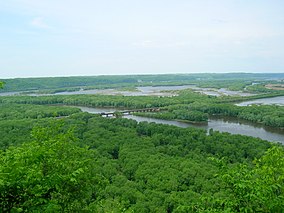
Wyalusing State Park /waɪ.əˈluːsɪŋ/ is a 2,628-acre (1,064 ha) Wisconsin state park at the confluence of the Mississippi and Wisconsin rivers in the village Bagley, just south of Prairie du Chien.
Wyalusing means "home of the warrior" in the Lenape language spoken by Munsee-Delaware tribes who settled in the area in the 19th century after being displaced from farther east. 500-foot-high (150 m) bluffs dotted with prehistoric Native American mounds look out over the river valleys. Two park resources have been recognized nationally: the Wyalusing Hardwood Forest is a National Natural Landmark and the Wyalusing State Park Mounds Archaeological District is on the National Register of Historic Places.

