| Wythenshawe Park | |
|---|---|
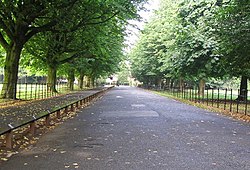
 The Driveway in Wythenshawe Park | |
 | |
| Type | Public |
| Location | Wythenshawe, Manchester |
| Coordinates | 53°24′15″N 2°16′29″W / 53.40422°N 2.27461°W |
| Area | 270 acres |
| Created | 1926 |
| Operated by | Manchester City Council |
| Awards | Green Flag |
| Public transit access | |
| Website | manchester.gov.uk |
Wythenshawe Park in Wythenshawe, south Manchester, England, covers an area of 270 acres. Wythenshawe Hall lies at its centre.
The park features woodland, bedding, grassland and meadows, sporting facilities, Wythenshawe community farm and a horticulture centre.[1][2]
- ^ "Facilities in the park". Manchester Council. Retrieved 19 March 2016.
- ^ "About the park". Manchester Council. Retrieved 19 March 2016.