Xupu County
溆浦县 Supu; Süpu | |
|---|---|
 | |
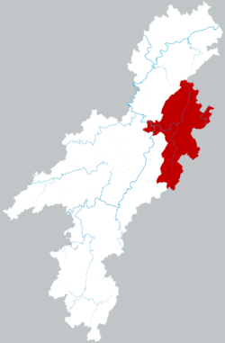
 Location of Xupu County within Huaihua | |
| Coordinates: 27°54′40″N 110°35′38″E / 27.911°N 110.594°E[1] | |
| Country | People's Republic of China |
| Province | Hunan |
| Prefecture-level city | Huaihua |
| Area | |
| • Total | 3,437.93 km2 (1,327.39 sq mi) |
| Population (2010)[3] | |
| • Total | 741,014 |
| • Density | 220/km2 (560/sq mi) |
| Time zone | UTC+8 (China Standard) |
| Postal code | 4193XX |
Xupu County (simplified Chinese: 溆浦县; traditional Chinese: 溆浦縣; pinyin: Xùpǔ Xiàn) is a county of Hunan Province, China, it is under the administration of Huaihua Prefecturel-level City.
Located on the west central Hunan, the county is bordered to the north by Yuanling County, to the northeast by Anhua County, to the east by Xinhua and Longhui Counties, to the south by Dongkou County, to the west by Hongjiang City, Zhongfang and Chenxi Counties. Xupu County covers 3,440.10 km2 (1,328.23 sq mi), as of 2015, It had a registered population of 932,400 and a resident population of 752,400.[4] Xupu County has 18 towns under its jurisdiction, the government seat is the town of Lufeng (卢峰镇).[5]
The Xu River (溆水) flows through the built-up area where it is joined by the Sandu River (三都河). Some kilometers downstream it joins the Yuan River.
- ^ "Xupu" (Map). Google Maps. Retrieved 2014-07-02.
- ^ Huaihua City Land Use Plan (2006–20)/《怀化市土地利用总体规划(2006-2020年)》.(in Chinese) Accessed 8 July 2014.
- ^ "怀化市2010年第六次全国人口普查主要数据公报" (in Chinese). Huaihua Statistical Bureau/怀化市统计局. Archived from the original on July 14, 2014. Retrieved 9 July 2014.
- ^ the population of Xupu County in 2015, according to the 2015年溆浦县国民经济和社会发展统计公报 [Statistical Communiqué of Xupu County on the 2015 National Economic and Social Development]. Huaihua People's Government. or ahmhxc.com
- ^ the divisions of Xupu County in 2015, according to the 《湖南省民政厅关于同意溆浦县乡镇区划调整方案的批复》(湘民行发〔2015〕49号) [result on adjustment of township-level administrative divisions of Xupu County on 19 November 2015]. rednet.cn Hunan. 2015-12-04.; also see 《湖南省乡镇区划调整改革109个县市区批复方案》. people.com Hunan. 2015-12-08. or xinhuanet.com
