Yalo
يالو Yalu | |
|---|---|
Village | |
| Etymology: From Hebrew Ajalon, "Place of the fallow deer"[1] | |
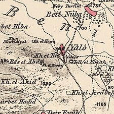
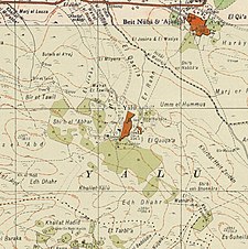
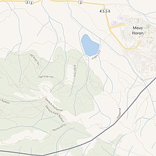
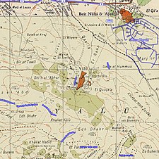
A series of historical maps of the area around Yalo (click the buttons) | |
Location within Mandatory Palestine | |
| Coordinates: 31°50′31″N 35°01′24″E / 31.84194°N 35.02333°E | |
| Palestine grid | 152/138 |
| Geopolitical entity | Mandatory Palestine |
| Subdistrict | Ramle |
| Date of depopulation | 7 June 1967 |
| Area | |
| • Total | 14,992 dunams (14.992 km2 or 5.788 sq mi) |
| Population (1961) | |
| • Total | 1,644 |
| Cause(s) of depopulation | Expulsion by Israeli forces |
| Current Localities | Canada Park |
Yalo (Arabic: يالو, also transliterated Yalu) was a Palestinian Arab village located 13 kilometres southeast of Ramla.[2] Identified by Edward Robinson as the ancient Canaanite and Israelite city of Aijalon.[2][3] During the Middle Ages, it was the site of a Crusader castle, Castrum Arnaldi.
Following the 1948 Arab-Israeli War, Jordan annexed the West Bank, including the village of Yalo.[4] Yalo's population increased dramatically owing to an influx of Palestinian refugees from neighbouring towns and villages depopulated during the war.
During the 1967 Six Day War, Yalo's inhabitants were expelled by the Israel Defense Forces (IDF) and the village was destroyed. Yalo and the area surrounding Latrun were annexed from Jordan by Israel.[5][6] Subsequently, with donations from Canadian benefactors, the Jewish National Fund built a recreational space, Canada Park, which contains the former sites of Yalo and two other neighbouring villages, Dayr Ayyub and Imwas.[7][8]
- ^ Palmer, 1881, p. 338
- ^ a b "Welcome to Yalu". Palestine Remembered. Retrieved 2008-08-27.
- ^ Robinson and Smith, 1841, vol 3, pp. 80-81
- ^ BADIL Occasional Bulletin No. 18 (June 2004). "From the 1948 Nakba to the 1967 Naksa". Badil. Archived from the original on 2008-05-09. Retrieved 2008-08-27.
{{cite web}}: CS1 maint: numeric names: authors list (link) - ^ Keinon, H. "Palestinians campaign to regain 'occupied' Latrun". Jerusalem Post.
- ^ "Palestinian Emigration and Israeli Land Expropriation in the Occupied Territories". Journal of Palestine Studies. 3 (1). University of California Press on behalf of the Institute for Palestine Studies: 106–118. Autumn 1973. doi:10.1525/jps.1973.3.1.00p0131i. JSTOR 2535530.
- ^ Palestine Remembered
- ^ John Dirlik (October 1991). ""Canada Park" Built on Ruins of Palestinian Villages". Retrieved 2008-08-27.
{{cite journal}}: Cite journal requires|journal=(help)


