| Yarriambiack | |
|---|---|
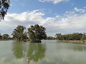
 Yarriambiack Creek at Brim | |
| Location | |
| Country | Australia |
| State | Victoria |
| Region | Murray Darling Depression (IBRA), Wimmera |
| LGAs | Horsham, Yarriambiack |
| Towns | Warracknabeal, Brim, Beulah |
| Physical characteristics | |
| Source | Great Dividing Range |
| 2nd source | Wimmera River |
| • location | near Drung Drung, east of Horsham |
| • coordinates | 36°42′26.7″S 142°24′43.9″E / 36.707417°S 142.412194°E |
| • elevation | 147 m (482 ft) |
| Mouth | Lake Coorong |
• location | east of Hopetoun |
• coordinates | 35°44′29.6″S 142°23′6.8″E / 35.741556°S 142.385222°E |
• elevation | 76 m (249 ft) |
| Length | 141 km (88 mi) |
| Basin features | |
| River system | Wimmera catchment |
| [1][2] | |
The Yarriambiack Creek, an inland intermittent watercourse of the Wimmera catchment, is located in the Wimmera region of the Australian state of Victoria. Rising on the northern slopes of the Great Dividing Range, the Yarriambiack Creek flows generally north and drains into Lake Coorong, one of a series of ephemeral lakes, northeast of Hopetoun.
- ^ "Yarriambiack Creek (entry 622381)". VICNAMES. Government of Victoria. Retrieved 23 October 2014.
- ^ "Map of Yarriambiack Creek, VIC". Bonzle Digital Atlas of Australia. Retrieved 23 October 2014.
