| Yea Victoria | |||||||||||||||
|---|---|---|---|---|---|---|---|---|---|---|---|---|---|---|---|
 High Street, Yea | |||||||||||||||
 | |||||||||||||||
| Coordinates | 37°12′45″S 145°25′26″E / 37.21250°S 145.42389°E | ||||||||||||||
| Population | 1,789 (2021 census)[1] | ||||||||||||||
| • Density | 10.090/km2 (26.134/sq mi) | ||||||||||||||
| Established | 1855 | ||||||||||||||
| Postcode(s) | 3717 | ||||||||||||||
| Elevation | 172 m (564 ft) | ||||||||||||||
| Area | 177.3 km2 (68.5 sq mi) | ||||||||||||||
| Time zone | AEST (UTC+10) | ||||||||||||||
| • Summer (DST) | AEDT (UTC+11) | ||||||||||||||
| Location | |||||||||||||||
| LGA(s) | Shire of Murrindindi | ||||||||||||||
| County | Anglesey | ||||||||||||||
| State electorate(s) | Eildon | ||||||||||||||
| Federal division(s) | Indi | ||||||||||||||
| |||||||||||||||
| |||||||||||||||
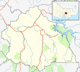
Yea (/ˈjeɪ/ YAY)[4] is a town in Victoria, Australia 112 kilometres (70 mi) north-east of the state capital Melbourne at the junction of the Goulburn Valley Highway and the Melba Highway, in the Shire of Murrindindi local government area. In an area originally inhabited by the Taungurung people, it was first visited by Europeans of the Hume and Hovell expedition in 1824, and within 15 years most of the land in the area had been taken up by graziers. Surveyed in 1855, the township grew as a service centre for grazing, gold-mining and timber-getting in the area.
The town has had a fairly stable population (around 1,100) since 1900, though it now has a relatively old population. The town economy is based around servicing the farming sector, and tourism, with good road links but little public transport. The town has education supplied by three schools (state primary and high schools, and a Catholic primary). It has three churches, and active sporting clubs.
Heritage sites around the town include the railway station buildings, Purcell's General Store (run by the same family for approximately 100 years), and the nearby Yea Flora Fossil Site, where the most ancient leafy foliage so far found on earth was discovered.
- ^ Cite error: The named reference
absYeawas invoked but never defined (see the help page). - ^ a b "Alexandra Monthly Temperatures". Commonwealth of Australia, Bureau of Meteorology. Retrieved 10 August 2012.
- ^ "Yea Monthly Rainfall". Commonwealth of Australia, Bureau of Meteorology. Retrieved 10 August 2012.
- ^ Macquarie Dictionary, Fourth Edition (2005). Melbourne, The Macquarie Library Pty Ltd. ISBN 1-876429-14-3
