| Yegorlyk | |
|---|---|
 The Yegorlyk near Novotroitskaya | |
 The Yegorlyk is the southernmost river in the Don basin | |
| Physical characteristics | |
| Source | |
| • location | 30 km (19 mi) south of Stavropol |
| • coordinates | 44°46′02″N 42°04′43″E / 44.76722°N 42.07861°E |
| Mouth | Manych |
• location | Proletarskoye Reservoir |
• coordinates | 46°32′58″N 41°51′03″E / 46.54944°N 41.85083°E |
| Length | 448 km (278 mi) |
| Basin size | 15,000 km2 (5,800 sq mi) |
| Basin features | |
| Progression | Manych→ Don→ Sea of Azov |
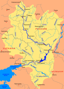
The Yegorlyk (Russian: Егорлык or Большой Егорлык) is a north-flowing river on the Black Sea-Caspian Steppe of southern Russia, a left tributary of the Manych. It is 448 kilometres (278 mi) long, and has a drainage basin of 15,000 square kilometres (5,800 sq mi).[1] Since the Manych flows into the Don it is the southernmost tributary of the Don, if one excludes the Kalaus.
- ^ «Река Егорлык (Большой Егорлык)», Russian State Water Registry