Yibna
يبنا Tel Yavne | |
|---|---|
 Mamluk minaret in Yibna | |
| Etymology: Built[1] | |
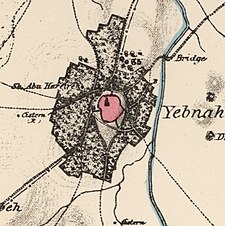
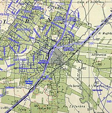
A series of historical maps of the area around Yibna (click the buttons) | |
Location within Mandatory Palestine | |
| Coordinates: 31°51′58″N 34°44′47″E / 31.86611°N 34.74639°E | |
| Palestine grid | 126/141 |
| Geopolitical entity | Mandatory Palestine |
| Subdistrict | Ramle |
| Date of depopulation | 4 June 1948[3] |
| Area | |
| • Total | 59,554 dunams (59.554 km2 or 22.994 sq mi) |
| Population (1945) | |
| • Total | 5,420[2] |
| Cause(s) of depopulation | Military assault by Yishuv forces |
| Secondary cause | Expulsion by Yishuv forces |
| Current Localities | Yavne,[4] Beit Raban, Kfar HaNagid, Beit Gamliel |
Yibna (Arabic: يبنا; Jabneh or Jabneel in Biblical times; Jamnia in Roman times; Ibelin to the Crusaders), or Tel Yavne, is an archaeological site and depopulated Palestinian town. The ruins are located southeast of the modern Israeli city of Yavne.
The town had a population of 5,420 in 1948, located 15 kilometers southwest of Ramla.[5] Most of the population fled after the fall of al-Qubeiba and Zarnuqa in late May, but armed males were forced back. Israeli Occupation forces took the town on June 5 and expelled the remaining population.[6]
It is a significant site for post-biblical Jewish history, as it was the location of the Council of Jamnia, considered the birthplace of modern Rabbinic Judaism. It is also significant in the history of the Crusades, as the location of the House of Ibelin.
- ^ Conder, C. R. (Claude Reignier); Palestine Exploration Fund; Kitchener, Horatio Herbert Kitchener; Palmer, Edward Henry (1881). The survey of Western Palestine : Arabic and English name lists collected during the survey. Robarts - University of Toronto. London : Committee of the Palestine Exploration Fund.
- ^ Department of Statistics, 1945, p. 30
- ^ Morris, Research Fellow Truman Institute Benny; Morris, Benny; Benny, Morris (2004). The Birth of the Palestinian Refugee Problem Revisited. Cambridge University Press. ISBN 978-0-521-00967-6.
- ^ Morris, Research Fellow Truman Institute Benny; Morris, Benny; Benny, Morris (2004). The Birth of the Palestinian Refugee Problem Revisited. Cambridge University Press. ISBN 978-0-521-00967-6.
- ^ Khalidi, 1992, p.421
- ^ Morris, Research Fellow Truman Institute Benny; Morris, Benny; Benny, Morris (2004). The Birth of the Palestinian Refugee Problem Revisited. Cambridge University Press. p. 259. ISBN 978-0-521-00967-6.


