| Yokun Ridge | |
|---|---|
 View from Lenox Mountain | |
| Highest point | |
| Elevation | 2,139 ft (652 m) |
| Dimensions | |
| Length | 9 mi (14 km) north-south |
| Geography | |
| Country | United States |
| State | Massachusetts |
| Region | Berkshire County |
| Range coordinates | 42°21′5″N 73°20′16″W / 42.35139°N 73.33778°W |
| Parent range | Taconic Mountains |
| Biome | northern hardwood forest |
| Geology | |
| Orogeny | Taconic orogeny |
| Rock age | 440 million years |
| Rock type | thrust fault |
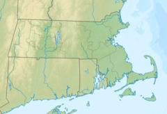
Yokun Ridge consisting mainly of West Stockbridge Mountain and the Lenox Mountain massif, is a ten-mile stretch of the Taconic Mountains south of Pittfield, Mass. The term was invented in 1971 by a conservation group to draw attention to a perceived geographical continuity. The name was accepted in 2009 by the United States Board on Geographic Names.[1][2] The area is notable for its recreational and scenic value, as well as its conserved land and proximity to the tourist attractions of Lenox and Stockbridge. Yokun Ridge is in West Stockbridge, Stockbridge, Lenox, Richmond, and Pittsfield, Massachusetts. Approximately one-third of the zone is protected as open space reserve, municipal watershed, and wildlife sanctuary.[3]
