| Yolo Bypass | |
|---|---|
 View of the flooded Yolo Bypass, looking southwest from West Sacramento (2017) | |
| Coordinates | 38°33′N 121°36′W / 38.55°N 121.60°W |
| Country | United States |
| State(s) | California |
| Characteristics | |
| Area | 59,000 acres (24,000 ha) |
| Hydrology | |
| River(s) | Sacramento, San Joaquin, American |
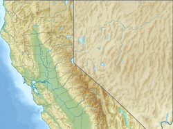
The Yolo Bypass is one of the two flood bypasses in California's Sacramento Valley located in Yolo and Solano Counties.[1] Through a system of weirs, the bypass diverts floodwaters from the Sacramento River away from the state's capital city of Sacramento and other nearby riverside communities.[2]
During wet years, the bypass can be full of water. The main input to the bypass is through the passive Fremont Weir, where water spills from the Sacramento into the bypass if it reaches the 33.5 feet (10.2 m) crest. Downstream, the Sacramento Weir, just north of the city of West Sacramento, can also be opened to divert additional waters from the Sacramento if needed. From the west, Cache Creek drains into the bypass. The bypass itself runs south, parallel to the Sacramento, and drains into the Sacramento-San Joaquin Delta, a few miles north of Rio Vista.
The bypass is crossed by the Yolo Causeway, a long highway bridge on Interstate 80, linking West Sacramento and the city of Davis, as well as by a rail causeway just north of the Yolo Causeway used by freight and Amtrak trains. To the north, Interstate 5 also crosses the bypass on the Elkhorn Causeway, east of the city of Woodland.
- ^ "A Framework for the Future: Yolo Bypass Management Strategy" (PDF). Yolo Bypass Working Group, Yolo Basin Foundation, and Jones & Stokes. August 2001. Retrieved June 28, 2018.
- ^ Tokita, Joyce; Cameron-Harley, Jamie. "Beneath the Flood". California Department of Water Resources. Retrieved February 28, 2009.
