| York River | |
|---|---|
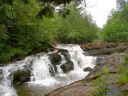
 Egan Chute on the York River, near Bancroft | |
| Location | |
| Country | Canada |
| Province | Ontario |
| Regions | |
| Counties | |
| Physical characteristics | |
| Source | Yorkend Lake |
| • location | Dysart et al, Haliburton County, Central Ontario |
| • coordinates | 45°18′01″N 78°20′21″W / 45.30028°N 78.33917°W |
| • elevation | 497 m (1,631 ft) |
| Mouth | Madawaska River |
• location | Madawaska Valley, Renfrew County, Eastern Ontario |
• coordinates | 45°20′08″N 77°34′43″W / 45.33556°N 77.57861°W |
• elevation | 283 m (928 ft) |
| Basin features | |
| Progression | Madawaska River→ Ottawa River→ St. Lawrence River→ Gulf of St. Lawrence |
| River system | Saint Lawrence River drainage basin |
The York River is a river in Renfrew County, Hastings County and Haliburton County in Ontario, Canada.[1][2] The river is in the Saint Lawrence River drainage basin, and flows from the southern extension of Algonquin Provincial Park to the Madawaska River.
The river alternates between fast flowing portions in steep sided gorges to slower movement through post-glacial sand flats. In these are changes in the river course has created ox-bows and abandoned ox-bows that are now ponds and wetlands.
- ^ "York River". Geographical Names Data Base. Natural Resources Canada. Retrieved 2012-10-21.
- ^ "York River". Atlas of Canada. Natural Resources Canada. 2010-02-04. Retrieved 2012-10-21. Shows the course of the river highlighted on a topographic map.
