Zumbro Falls | |
|---|---|
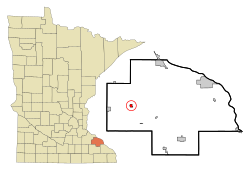
 Location of Zumbro Falls, Minnesota | |
| Coordinates: 44°17′0″N 92°25′29″W / 44.28333°N 92.42472°W | |
| Country | United States |
| State | Minnesota |
| County | Wabasha |
| Area | |
| • Total | 0.62 sq mi (1.60 km2) |
| • Land | 0.58 sq mi (1.51 km2) |
| • Water | 0.03 sq mi (0.08 km2) |
| Elevation | 843 ft (257 m) |
| Population (2020) | |
| • Total | 155 |
| • Density | 264.96/sq mi (102.34/km2) |
| Time zone | UTC-6 (Central (CST)) |
| • Summer (DST) | UTC-5 (CDT) |
| ZIP code | 55991 |
| Area code | 507 |
| FIPS code | 27-72310[2] |
| GNIS feature ID | 0654507[3] |
Zumbro Falls is a city along the Zumbro River in Wabasha County, Minnesota, United States. The population was 155 at the 2020 census.[4] U.S. Highway 63 and Minnesota 60 intersect in Zumbro Falls.
- ^ "2020 U.S. Gazetteer Files". United States Census Bureau. Retrieved July 24, 2022.
- ^ "U.S. Census website". United States Census Bureau. Retrieved January 31, 2008.
- ^ "US Board on Geographic Names". United States Geological Survey. October 25, 2007. Retrieved January 31, 2008.
- ^ "Explore Census Data". data.census.gov. Retrieved May 19, 2024.