| Zuya | |
|---|---|
 | |
 | |
| Native name |
|
| Location | |
| Country | Disputed: |
| Autonomous republic | Crimea (de jure) |
| Physical characteristics | |
| Source | Choban-Suat |
| • location | Dolgorukovskaya Yayla |
| • coordinates | 44°54′11″N 34°21′37″E / 44.90306°N 34.36028°E |
| • elevation | 707 m |
| Mouth | Salhyr |
• coordinates | 45°13′10″N 34°6′47″E / 45.21944°N 34.11306°E |
| Length | 55 km |
| Basin size | 421 km² |
| Discharge | |
| • location | Balanove |
| • average | 0.133 m³/sec |
| • maximum | 0.302 m³/sec |
| Basin features | |
| Tributaries | |
| • left | |
| • right | Montanai |
 | |
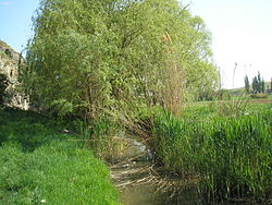
The Zuya (Crimean Tatar: Zuya, Зуя; Ukrainian: Зуя; Russian: Зуя) is a river in Crimea, Ukraine, a tributary of the Salhyr river, draining into the Sea of Azov basin. The river is 49 kilometres long with a catchment area of 421 square kilometres. The slope is 13.0 metres per kilometre. In its upper reaches, the valley is V-shaped, and further downstream, it becomes trough-shaped, with a width of 0.6-2 kilometres. The riverbed is winding, with a width of 1-5 metres. During low-water years, it may dries up. The river is used for irrigation purposes, and for this purpose, the Balonov Reservoir has been constructed.