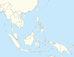
 | |
| UTC time | 1839-03-23 24:30 |
|---|---|
| Local date | 23 March 1839 |
| Local time | 04:00 |
| Magnitude | 7.9–8.3 Mw |
| Epicenter | 21°54′N 96°00′E / 21.9°N 96.0°E |
| Fault | Sagaing Fault |
| Areas affected | Konbaung dynasty (present–day Myanmar) |
| Max. intensity | MMI XI (Extreme) |
| Foreshocks | Yes |
| Aftershocks | Yes |
| Casualties | 300–400 dead |
The 1839 Ava earthquake, also known as the Amarapura earthquake or Inwa earthquake, was a disastrous seismic event that struck present-day central Myanmar on March 23.[1] This earthquake with an estimated moment magnitude as high as 8.3, was one of the largest in the country, since 1762. It was assigned a maximum of XI (Extreme) on the Modified Mercalli intensity scale, and was felt in Rangoon and Bhamo.[2] Damage was enormous in Ava, resulting in the death of hundreds.
- ^ Oldham, Thomas. "A Catalogue of Indian Earthquakes from the earliest time to the end of AD 1869". Memoirs of the Geological Survey of India. XIX.
- ^ National Geophysical Data Center (1972). "Significant Earthquake Information". National Geophysical Data Center / World Data Service (NGDC/WDS): NCEI/WDS Global Significant Earthquake Database. NOAA National Centers for Environmental Information. doi:10.7289/V5TD9V7K.
