| UTC time | 1998-07-17 08:49:13 |
|---|---|
| ISC event | 1167076 |
| USGS-ANSS | ComCat |
| Local date | July 17, 1998 |
| Local time | 6:49 pm |
| Duration | 19 seconds[1] |
| Magnitude | 7.0 Mw[2] |
| Depth | 30 km (19 mi)[2] |
| Epicenter | 3°07′S 142°26′E / 3.11°S 142.44°E[2] |
| Type | Dip-slip[1] |
| Areas affected | Papua New Guinea |
| Max. intensity | MMI VIII (Severe)[3] |
| Tsunami | 15 m (49 ft)[4] |
| Casualties | 2,183–2,700 dead[4] Thousands injured[4] |
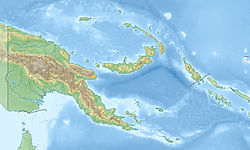
The 1998 Papua New Guinea earthquake occurred on July 17 with a moment magnitude of 7.0 and a maximum Mercalli intensity of VIII (Severe). The event occurred on a reverse fault near the north coast region of Papua New Guinea, 25 kilometers (16 mi) from the coast near Aitape and caused a large submarine landslide which caused a tsunami that hit the coast, killing between at least 2,183 and 2,700 people and injuring thousands.
- ^ a b Cite error: The named reference
Kikuchiwas invoked but never defined (see the help page). - ^ a b c Cite error: The named reference
ISC-GEMwas invoked but never defined (see the help page). - ^ Cite error: The named reference
EXPO-CATwas invoked but never defined (see the help page). - ^ a b c Cite error: The named reference
PAGER-CATwas invoked but never defined (see the help page).
