| UTC time | 2004-11-21 11:41:07 |
|---|---|
| ISC event | 7439677 |
| USGS-ANSS | ComCat |
| Local date | November 21, 2004 |
| Local time | 07:41:07 |
| Magnitude | 6.3 Mw [1] |
| Depth | 13 km (8 mi) [1] |
| Epicenter | 15°41′N 61°42′W / 15.68°N 61.7°W [1] |
| Fault | Roseau Fault |
| Type | Oblique-normal[2] |
| Total damage | Moderate [3] |
| Max. intensity | EMS-98 VIII (Heavily damaging) |
| Peak acceleration | 0.21 g [4] |
| Tsunami | 2 m (6.6 ft) |
| Aftershocks | 5.8 Mw Feb 14, 2005 |
| Casualties | 1 dead, 13 injured [2] 40 displaced [2] |
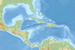
The 2004 Les Saintes earthquake occurred at 07:41:07 local time on November 21, 2004 with a moment magnitude of 6.3 and maximum European macroseismic intensity of VIII (Heavily damaging). The shock was named for Îles des Saintes "Island of the Saints", a group of small islands to the south of Guadeloupe, which is an overseas department of France. Although it occurred near the Lesser Antilles subduction zone, this was an intraplate, normal fault event. It resulted in one death, 13 injuries, and 40 people being made homeless, but the overall damage was considered moderate. A small, nondestructive tsunami was reported, but run-up and inundation distances were difficult to measure due to a storm that occurred on the day of the event. Unusual effects at a volcanic lake on Dominica were also documented, and an aftershock caused additional damage three months later.
- ^ a b c Cite error: The named reference
ISC-GEMwas invoked but never defined (see the help page). - ^ a b c Cite error: The named reference
PAGER-CATwas invoked but never defined (see the help page). - ^ Cite error: The named reference
NGDCwas invoked but never defined (see the help page). - ^ Cite error: The named reference
Douglaswas invoked but never defined (see the help page).


