| UTC time | 2012-04-11 08:38:36 |
|---|---|
| 2012-04-11 10:43:10 | |
| ISC event | 600860404 |
| USGS-ANSS | ComCat |
| ComCat | |
| Local date | 11 April 2012 |
| Local time | 15:38 |
| 17:43 | |
| Magnitude | 8.6 Mw[1] |
| 8.2 Mw | |
| Depth | 20.0 km (12.4 mi) |
| 25.1 km (15.6 mi) | |
| Epicenter | 2°18′40″N 93°03′47″E / 2.311°N 93.063°E[2] |
| Type | Strike-slip – Intraplate[3] |
| Areas affected | Indonesia |
| Max. intensity | MMI VII (Very strong) |
| Tsunami | Yes, 1m (3.5ft) |
| Foreshocks | 7.2 Mw 10 Jan at 18:36[1] |
| Aftershocks | 8.2 Mw 11 April at 10:43[1] |
| Casualties | 10 dead[4] 12 injured[4] |
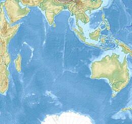
The 2012 Indian Ocean earthquakes were magnitude 8.6 and 8.2 Mw undersea earthquakes that struck near the Indonesian province of Aceh on 11 April at 15:38 local time. Initially, authorities feared that the initial earthquake would cause a tsunami and warnings were issued across the Indian Ocean; however, these warnings were subsequently cancelled.[5][6] These were unusually strong intraplate earthquakes and the largest strike-slip earthquake ever recorded.[3]
- ^ a b c Cite error: The named reference
Weiwas invoked but never defined (see the help page). - ^ Cite error: The named reference
usgswas invoked but never defined (see the help page). - ^ a b Prasad, R. (12 April 2012). "Why April 11 quake was caused by a strike-slip fault". The Hindu. Chennai, India. Retrieved 13 April 2012.
- ^ a b Cite error: The named reference
USGSwas invoked but never defined (see the help page). - ^ NewsCore (11 April 2012). "Indian Ocean tsunami alert cancelled after two strong quakes hit off Sumatra, Indonesia". Herald Sun. Retrieved 11 April 2012.
- ^ "Huge quake strikes off Indonesia, tsunami warning issued". Reuters. 11 April 2012. Retrieved 11 April 2012.
