This article has multiple issues. Please help improve it or discuss these issues on the talk page. (Learn how and when to remove these messages)
|
| A17 | ||||
|---|---|---|---|---|
| Route information | ||||
| Length | 59.4 mi[1] (95.6 km) | |||
| Major junctions | ||||
| West end | 53°05′41″N 0°47′00″W / 53.0946°N 0.7833°W | |||
| ||||
| To | 52°44′33″N 0°22′44″E / 52.7426°N 0.3790°E | |||
| Location | ||||
| Country | United Kingdom | |||
| Constituent country | England | |||
| Counties | Nottinghamshire, Lincolnshire, Norfolk | |||
| Primary destinations | Sleaford | |||
| Road network | ||||
| ||||
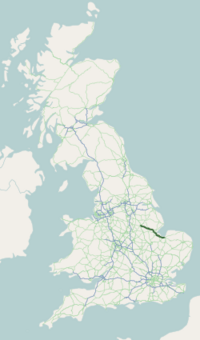
The A17 road is a mostly single carriageway road linking Newark-on-Trent in Nottinghamshire, England, to King's Lynn in Norfolk. It stretches for a distance of 62 miles travelling across the flat fen landscapes of southern Lincolnshire and western Norfolk and links the East Midlands with East Anglia. The road is notable for its numerous roundabouts and notoriously dangerous staggered junctions and also for its most famous landmark, the Cross Keys Bridge at Sutton Bridge close to the Lincolnshire/Cambridgeshire/Norfolk borders which carries the road over the River Nene.

