| A3055 | |
|---|---|
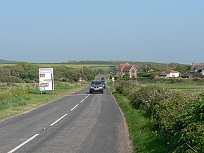
 Military Road at Brook. This is the end of the clearway section, as denoted by the signs near the junction. The destination on the sign is Ventnor: despite the fact the road goes to Ryde, motorists travelling there would have a shorter journey via Brook Village and Newport | |
| Major junctions | |
| North end | Ryde |
| West end | Totland |
| Location | |
| Country | United Kingdom |
| Constituent country | England |
| Road network | |
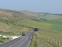
The A3055 is an A-Class Road on the Isle of Wight in Southern England. It forms the Southern portion of the circular around-the-Island A-class loop, the northern section being the A3054. The stretch along the south-west coast of the Island is formed by the Military Road.
Because of the road's relatively short length, there are no confirmatory signs with distances, although on a few direction signs at junctions there are distances to the next town. The final destination of the road (Freshwater/Totland or Ryde), in common with most UK roads, is not signed along the whole length of the route. As well as fitting with national practice, this is also because anybody wishing to travel from Totland to Ryde by road would do so via the North coast A3054, as it is much more direct.
Numerous landslips have affected the road in recent history, particularly around Undercliff Drive between Ventnor and Niton, which has resulted in sections being closed for repair on several occasions.

