This article needs additional citations for verification. (April 2013) |
| A456 | ||||
|---|---|---|---|---|
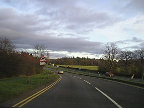
 The A456 passing near Clent Hills | ||||
| Route information | ||||
| Length | 40 mi[1] (64 km) | |||
| Major junctions | ||||
| East end | Birmingham | |||
| West end | Woofferton | |||
| Location | ||||
| Country | United Kingdom | |||
| Primary destinations | Birmingham Kidderminster Leominster | |||
| Road network | ||||
| ||||
Known as the Hagley Road in Birmingham, the A456 is a main road in England running between Central Birmingham and Woofferton, Shropshire, south of Ludlow. Some sections of the route, for example Edgbaston near Bearwood, are also the route of the Elan Aqueduct which carries Birmingham's water supply from the Elan Valley.[2]
- ^ "Driving directions to 52.312211, -2.704613". Google Maps. Retrieved 17 April 2014.
- ^ Ordnance Survey map, 1:2500 scale, 1903, annotation at junction of Hagley Road and Barnsley Road, Bearwood.
