| A5036 | |
|---|---|
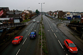
 Northern section looking south-west towards the docks | |
| Route information | |
| Length | 8.0 mi (12.9 km) |
| Northern section | |
| North-east end | Switch Island, Netherton |
| |
| South-west end | Royal Seaforth Dock |
| Southern section | |
| Length | 4.6 mi (7.4 km) |
| North end | Regent Road, Bootle |
| Major intersections | |
| South end | Brunswick railway station |
| Location | |
| Country | United Kingdom |
| Road network | |
The A5036 is a road in Merseyside, England, which comprises two sections separated by a gap of around 1.6 miles (2.6 km).[1]
