| A588 | |
|---|---|
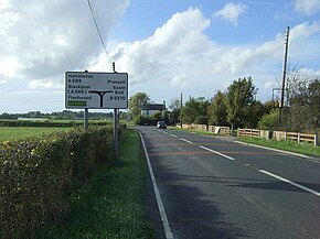
 The A588 (as Head Dyke Lane in this section) in Preesall | |
| Route information | |
| Length | 20 mi (32 km) |
| Major junctions | |
| SW end | |
| NE end | |
| Location | |
| Country | United Kingdom |
| Constituent country | England |
| Road network | |
The A588 is a road in western Lancashire, England, which runs for around 20 miles (32 km), from Poulton-le-Fylde northeastwards to Lancaster. It is the main route serving the Over Wyre areas of the Fylde.
