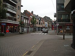
Aalter | |
|---|---|
 | |
| Coordinates: 51°05′N 03°27′E / 51.083°N 3.450°E | |
| Country | |
| Community | Flemish Community |
| Region | Flemish Region |
| Province | East Flanders |
| Arrondissement | Ghent |
| Government | |
| • Mayor | Pieter De Crem (CD&V) |
| • Governing party/ies | CD&V/N-VA |
| Area | |
| • Total | 119.85 km2 (46.27 sq mi) |
| Population (2022-01-01)[1] | |
| • Total | 29,340 |
| • Density | 240/km2 (630/sq mi) |
| Postal codes | 9880, 9881, 9910 |
| NIS code | 44084 |
| Area codes | 09 |
| Website | www.aalter.be |
Aalter (Dutch pronunciation: [ˈaːltər] ) is a municipality located between Bruges and Ghent in the Belgian province of East Flanders. The municipality comprises the towns of Aalter, Bellem, Lotenhulle, Poeke, Knesselare and Ursel. It is bordered on the north by Maldegem, on the east by Zomergem and Nevele, on the south by Deinze, and on the west by the province of West Flanders. The mayor is Pieter De Crem.[2]
Effective 1 January 2019, the municipality of Knesselare was merged into Aalter.[3] Aalter was home to 29,242 people in 2021.[4]
- ^ "Bevolking per gemeente op 1 januari 2022". Statbel.
- ^ "Pieter De Crem grijpt alle macht". Het Laatste Nieuws (in Dutch). Retrieved 7 May 2022.
- ^ "Knesselare én Aalter bundelen hun krachten in de nieuwe fusiegemeente Aalter". Communicatiehuis (in Dutch). Retrieved 7 May 2022.
- ^ "Bevolking per statistische sector - Sector 44084". Statistics Belgium. Retrieved 7 May 2022.


