Abbotsford | |
|---|---|
| City of Abbotsford | |
|
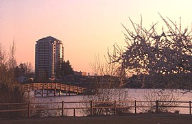
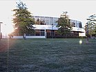
From top, left to right: Abbotsford from Mill Lake, The Reach Gallery Museum, Mill Lake, University of the Fraser Valley, Abbotsford International Airport | |
|
| |
| Nicknames: "Abby", City in the Country, Raspberry Capital of Canada, A-Town | |
| Motto(s): | |
Location of Abbotsford in British Columbia | |
| Coordinates: 49°3′N 122°19′W / 49.050°N 122.317°W | |
| Country | Canada |
| Province | British Columbia |
| Regional district | Fraser Valley |
| Established | 1892 |
| Incorporated | 1945 |
| Amalgamation with the District of Sumas | 1972 |
| Amalgamation with the District of Matsqui | 1995 |
| Government | |
| • Body | Abbotsford City Council |
| • Mayor | Ross Siemens[1] |
| • City Council | List of MPs
|
| • MP | List of MPs
|
| • MLA | |
| Area | |
| • Land | 375.33 km2 (144.92 sq mi) |
| • Metro | 606.72 km2 (234.26 sq mi) |
| • Rank | 1st in British Columbia |
| Elevation | 38 m (124 ft) |
| Population | |
• City | 153,524 |
• Estimate (2022)[5] | 168,478 |
| • Rank | 32nd in Canada 5th in British Columbia |
| • Density | 409.0/km2 (1,059/sq mi) |
| • Metro | 195,726 |
| • Metro density | 322.6/km2 (836/sq mi) |
| Demonym | Abbotsfordian |
| Time zone | UTC−8 (PST) |
| • Summer (DST) | UTC−7 (PDT) |
| Forward sortation area | |
| Area codes | 604, 778, 236, 672 |
| GDP (Abbotsford-Mission CMA) | CA$6.9 billion (2016)[6] |
| GDP per capita (Abbotsford-Mission CMA) | CA$38,162 (2016) |
| Website | abbotsford |
Abbotsford is a city in British Columbia next to the Canada–United States border, Greater Vancouver, and the Fraser River. With a census population of 153,569 people (2021), it is the largest municipality in the province outside metropolitan Vancouver.[3] Abbotsford–Mission has the third-highest proportion of visible minorities among census metropolitan areas in Canada, after the Greater Toronto Area and the Greater Vancouver CMA.[7] It is home to Tradex, the University of the Fraser Valley, and Abbotsford International Airport.
As of the 2021 census, it is the largest municipality of the Fraser Valley Regional District and the fifth-largest municipality of British Columbia. The Abbotsford–Mission metropolitan area of around 195,726 inhabitants as of the 2021 census is the 23rd largest census metropolitan area in Canada.[4] It has also been named by Statistics Canada as Canada's most generous city in terms of charitable donations for nine straight years.[8]
The community of 375.55 square kilometres (145.00 sq mi) is the largest city by area in British Columbia. The municipality's southern boundary is the Canada–United States border. In Canada, it is bordered by the Township of Langley to the west, the City of Mission to the north, and the City of Chilliwack to the east. Abbotsford borders the town of Sumas, Washington, to the south. Much of Abbotsford has views of Mount Baker (to the southeast, in Washington) and the Coast Mountains (to the north).
- ^ "Ross Siemens | City of Abbotsford".
- ^ "City of Abbotsford – City Council". www.abbotsford.ca.
- ^ a b c Cite error: The named reference
2021censuswas invoked but never defined (see the help page). - ^ a b c "Population and dwelling counts: Canada, provinces and territories, census metropolitan areas and census agglomerations". Statistics Canada. February 9, 2022. Retrieved March 18, 2022.
- ^ Services, Ministry of Citizens'. "Population Estimates – Province of British Columbia". www2.gov.bc.ca. Retrieved March 19, 2023.
- ^ "Table 36-10-0468-01 Gross domestic product (GDP) at basic prices, by census metropolitan area (CMA) (x 1,000,000)". Statistics Canada. January 27, 2017. Archived from the original on January 22, 2021. Retrieved April 27, 2021.
- ^ "B.C. is nation's most ethnically diverse province: StatsCan". CBC News. April 2, 2008.
- ^ "2011: The year in review in Abbotsford". Abbotsford News. Archived from the original on April 19, 2012. Retrieved December 30, 2011.


