Abu Shusha
أبو شوشة | |
|---|---|
| Etymology: Father of the top-knots[1][2] | |
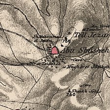
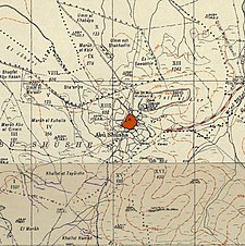
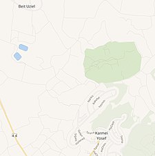
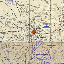
A series of historical maps of the area around Abu Shusha (click the buttons) | |
Location within Mandatory Palestine | |
| Coordinates: 31°51′25″N 34°54′56″E / 31.85694°N 34.91556°E | |
| Palestine grid | 142/140 |
| Geopolitical entity | Mandatory Palestine |
| Subdistrict | Ramle |
| Date of depopulation | 14 May 1948[6] |
| Area | |
| • Total | 9,425[5] dunams (9.4 km2 or 3.6 sq mi) |
| Population (1945) | |
| • Total | 870−950[3]−870[4][5] |
| Cause(s) of depopulation | Military assault by Yishuv forces |
| Current Localities | Ameilim,[7] Pedaya[7] |
Abu Shusha (Arabic: أبو شوشة) was a Palestinian Arab village in the Ramle Subdistrict of Mandatory Palestine, located 8 km southeast of Ramle. It was ethnically cleansed in May 1948.
Abu Shusha was located on the slope of Tell Jezer/Tell el-Jazari, which is commonly identified with the ancient city of Gezer. In April–May 1948, during the 1948 Arab–Israeli War, Abu Shusha was attacked several times. The final assault began on May 13, one day prior to Israel's declaration of independence. Abu Shusha residents attempted to defend the village, but the village was occupied on May 14. The civilians who had not already fled or been killed were expelled by May 21.[8] With their descendants, they numbered about 6,198 in 1998.
- ^ Palmer, 1881, p. 265
- ^ Conder and Kitchener, 1882, SWP II, p. 444
- ^ Karsh, Efraim. "How Many Palestinian Arab Refugees Were There?" Israel Affairs 17.2 (2011): 224-246. Academic Search Premier. Web. 29 May 2013.
- ^ Government of Palestine, Department of Statistics, 1945, p. 29
- ^ a b Government of Palestine, Department of Statistics. Village Statistics, April, 1945. Quoted in Hadawi, 1970, p. 66
- ^ Morris, 2004, p. xix, village #246. Also gives cause of depopulation
- ^ a b Khalidi, 1992, p. 358
- ^ Morris, 2004, pp. 256-257


