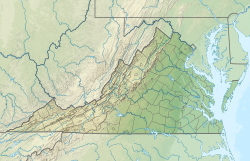
| Accotink Creek Tributary to Potomac River | |
|---|---|
 Cycling trail over Accotink Creek | |
| Location | |
| Country | United States |
| State | Virginia |
| County | Fairfax |
| City | Fairfax |
| Physical characteristics | |
| Source | Difficult Run divide |
| • location | Cobbdale, Virginia |
| • coordinates | 38°51′05″N 077°19′18″W / 38.85139°N 77.32167°W[1] |
| • elevation | 360 ft (110 m)[2] |
| Mouth | Potomac River (Accotink Bay) |
• location | Fort Belvior Military Reservation |
• coordinates | 38°41′56″N 077°09′40″W / 38.69889°N 77.16111°W[1] |
• elevation | 0 ft (0 m)[2] |
| Length | 23.86 mi (38.40 km)[3] |
| Basin size | 52.83 square miles (136.8 km2)[4] |
| Discharge | |
| • location | Potomac River (Accotink Bay) |
| • average | 61.46 cu ft/s (1.740 m3/s) at mouth with Potomac River[4] |
| Basin features | |
| Progression | southeast |
| River system | Potomac River |
| Tributaries | |
| • left | Bear Run Long Branch Flag Run Calomo Branch Field Lark Branch Long Branch |
| • right | Crock Branch Turkey Run Long Branch |
| Waterbodies | Lake Accotink |
| Bridges | Hill Street, Scott Drive, Warwick Avenue, US 29, Keith Avenue, Rust Hill Place, Chain Bridge Road, University Drive, US 50 (x2), Old Lee Hwy, Pickett Road, Barkley Drive, Prosperity Avenue, Woodburn Road, King Arthur Road, Accotink Drive, VA 236, VA 620, Old Keene Mill Road, VA 289, Hooes Road, Barta Road, VA 286, Fullerton Road, I-95, Telegraph Road, Ehlers Road, John J. Kingman Road, US 1, Poe Road |
Accotink Creek is a 25.0-mile-long (40.2 km)[5] tributary stream of the Potomac River in Fairfax County, Virginia, in the United States. At Springfield, Virginia, Accotink Creek is dammed to create Lake Accotink. The stream empties into the Potomac at Gunston Cove's Accotink Bay, to the west of Fort Belvoir.
- ^ a b "GNIS Detail - Accotink Creek". geonames.usgs.gov. US Geological Survey. Retrieved 11 March 2020.
- ^ a b "Accotink Creek Topo Map, Fairfax County VA (Fort Belvoir Area)". TopoZone. Locality, LLC. Retrieved 11 March 2020.
- ^ "ArcGIS Web Application". epa.maps.arcgis.com. US EPA. Retrieved 11 March 2020.
- ^ a b "Accotink River Watershed Report". Waters Geoviewer. US EPA. Retrieved 11 March 2020.
- ^ U.S. Geological Survey. National Hydrography Dataset high-resolution flowline data. The National Map Archived 2012-03-29 at the Wayback Machine, accessed August 15, 2011

