Acht | |
|---|---|
| Coordinates: 50°22′13″N 7°4′21″E / 50.37028°N 7.07250°E | |
| Country | Germany |
| State | Rhineland-Palatinate |
| District | Mayen-Koblenz |
| Municipal assoc. | Vordereifel |
| Government | |
| • Mayor (2019–24) | Helmut Thelen[1] |
| Area | |
• Total | 3.79 km2 (1.46 sq mi) |
| Elevation | 430 m (1,410 ft) |
| Population (2022-12-31)[2] | |
• Total | 78 |
| • Density | 21/km2 (53/sq mi) |
| Time zone | UTC+01:00 (CET) |
| • Summer (DST) | UTC+02:00 (CEST) |
| Postal codes | 56729 |
| Dialling codes | 02656 |
| Vehicle registration | MYK |
| Website | www.acht-eifel.de |
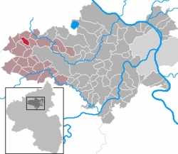
Acht (German pronunciation: [axt] ) is a municipality in the district of Mayen-Koblenz in Rhineland-Palatinate, western Germany. It is situated on the eastern edge of the Eifel.
Acht is part of Verbandsgemeinde of Vordereifel, whose head office is located in Mayen.
- ^ Cite error: The named reference
mayorwas invoked but never defined (see the help page). - ^ "Bevölkerungsstand 2022, Kreise, Gemeinden, Verbandsgemeinden" (PDF) (in German). Statistisches Landesamt Rheinland-Pfalz. 2023.


