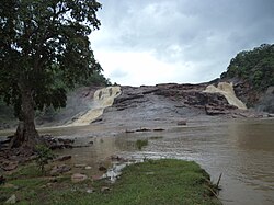
Adilabad district | |
|---|---|
 | |
 | |
| Country | |
| State | |
| Headquarters | Adilabad |
| Mandalas | 18 |
| Government | |
| • District collector | Sri Rajarshi Shah [1] |
| • Parliament Constituencies | Adilabad |
| • Assembly constituencies | Adilabad, Boath (ST), Khanapur (ST) |
| • MP | Godam Nagesh (BJP) |
| Area | |
• Total | 4,153 km2 (1,603 sq mi) |
| Population (2011) | |
• Total | 708,972 |
| • Density | 170/km2 (440/sq mi) |
| Demographics | |
| • Literacy | 63.46% |
| • Sex ratio | 989 |
| Time zone | UTC+05:30 (IST) |
| Vehicle registration | TG–01[2] |
| Website | adilabad |
Adilabad district is a district in the northern area of Telangana, India. It is known as the gateway district to South and Central India.[3] The district's headquarters is the town of Adilabad.[4]
Adilabad district is bounded by Asifabad district to the east, Nirmal district to the south, and the state of Maharashtra to the north and west. As of 2022, it is a part of the red corridor.[5]
- ^ "Adilabad District | Welcome To Adilabad District Web Portal | India". Adilabad.telangana.gov.in. Retrieved 20 March 2022.
- ^ "Vehicle Registration Codes For New Districts in Telangana".
- ^ "It's raining mandals in divided Adilabad". The Hindu. 6 October 2016. Retrieved 8 October 2016.
- ^ "Adilabad district district" (PDF). Official website of Adilabad district. Archived from the original (PDF) on 10 January 2017. Retrieved 29 June 2017.
- ^ "Adilabad Police on High Alert over Maoist Movement". 14 May 2022.