This article reads like a press release or a news article and may be largely based on routine coverage. (February 2017) |
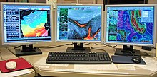
 AWIPS graphics workstation. | |
| Developer(s) | Northrop Grumman Information Technology Raytheon |
|---|---|
| Initial release | 1998 |
| Stable release | AWIPS II
/ 2011 |
| Written in | UNIX/Linux |
The Advanced Weather Interactive Processing System (AWIPS) is a technologically advanced processing, display, and telecommunications system that is the cornerstone of the United States National Weather Service's (NWS) operations.[1]
AWIPS is a complex network of systems that ingests and integrates meteorological, hydrological, satellite, and radar data, and also processes and distributes the data to 135 Weather Forecast Offices (WFOs) and River Forecast Centers (RFCs) nationwide. Weather forecasters utilize the capabilities of AWIPS to make increasingly accurate weather, water, and climate predictions, and to dispense rapid, highly reliable warnings and advisories.
The AWIPS system architectural design is driven by expandability, flexibility, availability, and portability. The system is easily expandable to allow for the introduction of new functionality and the augmentation of network and processing capabilities. AWIPS is designed so that software and data can be migrated to new platforms as technology evolves.[2]
- ^ NWS. “Advanced Weather Interactive Processing System (AWIPS) Hardware.” [LINK MAY NO LONGER BE ACTIVE] http://www.nws.noaa.gov/ops2/ops24/awips.htm.
- ^ NWS. “Overview of the AWIPS System.” [LINK MAY NO LONGER BE ACTIVE] http://www.crh.noaa.gov/lmk/?n=awipsoverview