| National Highway 1 | |
|---|---|
| Dari: شاهراه حلقوی افغانستان Pashto: د افغانستان حلقوي سړک | |
| Route information | |
| Part of | |
| Location | |
| Country | Afghanistan |
| Highway system | |


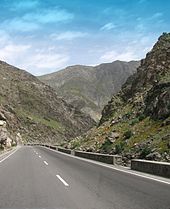
National Highway 01 or NH01, formally called the Ring Road (Pashto: د افغانستان حلقوي سړک; Dari: شاهراه حلقوی افغانستان), is a 2,200-kilometre (1,400 mi) two-lane road network circulating inside Afghanistan, connecting the following major cities (clockwise): Kabul, Maidan Shar, Ghazni, Kandahar, Delaram, Herat, Maymana, Sheberghan, Mazar-i-Sharif, Puli Khumri and back to Kabul. It has extensions that connect Jalalabad, Bamyan, Khost, Lashkargah, Zaranj (Route 606), Farah, Islam Qala, Torghundi, and Kunduz. It is part of AH1, the longest route of the Asian Highway Network. National Highway 01 consists of four major sections, NH0101 to NH0104, linking the major economic centers.[1]
- ^ "Application of Road Numbering System National Highway", [1] Archived 7 May 2017 at the Wayback Machine The Ministry of Public Works (16 October 2015)