Agudos | |
|---|---|
 | |
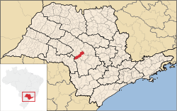
 Location in São Paulo state | |
| Coordinates: 22°28′26″S 48°59′1″W / 22.47389°S 48.98361°W | |
| Country | Brazil |
| Region | Southeast |
| State | São Paulo |
| Area | |
| • Total | 966 km2 (373 sq mi) |
| Elevation | 580 m (1,900 ft) |
| Population (2020 [1]) | |
| • Total | 37,401 |
| • Density | 39/km2 (100/sq mi) |
| Time zone | UTC−3 (BRT) |
| Postal code | 17120-000 |
Agudos is a Brazilian municipality located in the west-central part of the state of São Paulo. The population is 37,401 (2020 est.) in an area of 966 km2.[2] Distance from the capital is 330 km and is accessed by the Rodovia Marechal Rondon. The municipality was established in 1898, when it was separated from Lençóis.[3]

