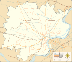
Ahiran | |
|---|---|
Village | |
| Coordinates: 25°21′10″N 82°55′58″E / 25.352719°N 82.932677°E | |
| Country | |
| State | Uttar Pradesh |
| District | Varanasi district |
| Tehsil | Pindra |
| Elevation | 78.662 m (258.077 ft) |
| Population (2011) | |
| • Total | 2,115 |
| Languages | |
| • Official | Hindi |
| Time zone | UTC+5:30 (IST) |
| Postal code | 221204 |
| Telephone code | +91-5450 |
| Vehicle registration | UP65 XXXX |
| Village code | 208848 |
| Lok Sabha constituency | Varanasi |
| Vidhan Sabha constituency | Pindra |
Ahiran is a village in Pindra Tehsil of Varanasi district in the Indian state of Uttar Pradesh. Ahiran falls under Nathaiya Pur gram panchayat. The village is about 10.6 kilometers North-West of Varanasi city, 282 kilometers South-East of state capital Lucknow and 805 kilometers South-East of the national capital Delhi.[1][2][3][4][5][6]
- ^ "Village coordinates". latlong.net. Archived from the original on 7 August 2017. Retrieved 5 March 2015.
- ^ "Elevation". daftlogic.com. Retrieved 5 March 2015.
- ^ "Demography". 2011 census. Retrieved 5 March 2015.
- ^ "Village code & Tehsil". Local Government directory. Retrieved 5 March 2015.
- ^ "Village details". Wiki edit. Retrieved 5 March 2015.
- ^ "Delimitation of Parliamentary and Assembly Constituencies Order, 2008" (PDF). Election Commission of India official website. Retrieved 5 March 2015.


